A model approach
The UK government’s Building Information Modelling (BIM) Level 2 requirement will help define and regulate how information is managed across its assets from 2016. BIM specialists James Daniel and Jane Pritchard take a look at what this means for flood risk management.
Good flood risk management depends on many things — from robust asset design and management to generating funding and community engagement. The challenge lies in knowing how to store the information needed to do these things, and manage asset data in a consistent and integrated way — something the government’s BIM Level 2 mandate is centred on.
BIM in a nutshell
BIM is not a single piece of software, but a process underpinned by people and technologies that brings together all of the information needed to design, build, operate and manage a construction project into a single, digital format using a set of British Standards. The data is then used to generate an information model or database about what will be built, how it will be built and how it will perform.
BIM is produced as a 3D model, but can also include information like quantity of materials and their cost, an asset’s installation date — even how to operate it. Ultimately, infinite data can be added to the model as a project progresses. This information can be shared with every person involved in a project — from the engineer and Lead Local Flood Authority to homeowners who rely on a flood risk management asset for protection. BIM’s integrated and collaborative approach to information management eliminates error, ensures quality and reduces costs.
BIM’s integrated and collaborative approach to information management eliminates error, ensures quality and reduces costs.
One version of the truth
Despite the overall construction industry’s push towards digital project delivery and BIM Level 2, some engineers still tend to design flood risk assets on paper and give them to a computer-aided design (CAD) technician to copy into a computerised 2D drawing, leaving the engineer to visualise how the design should be built. The manual input required in producing and checking the drawings can lead to potential errors which in turn results in construction problems, waste, standing time on site and high, unnecessary costs.
BIM is just as much about people and collaboration as it is about integrated, digital processes; flood risk management professionals can build a single source of project data, helping to eliminate errors throughout asset construction and management. This makes it easier for all stakeholders, including clients, contractors, supply chain and local communities, to review and contribute to a visual ‘prototype’ of an asset or scheme before it’s built.
The new standards
So what exactly do the BIM Level 2 requirements entail? In 2011, the UK government announced that, from 2016, all publicly-funded construction projects must be BIM Level 2 compliant. Essentially, Level 0 refers to unmanaged CAD printed on paper, while Level 1 refers to CAD-generated 2D and 3D data, sometimes to particular standards. Level 2 takes a major step forward, requiring all project data to be managed in a single source environment and relies on collaboration throughout the entire project and asset life cycle.
The UK’s Government Construction Strategy 2011 states that around 20 per cent of a construction project budget is spent on building the asset, with the remaining 80 per cent going towards operating it throughout its lifetime. Level 2 is about making this 80 per cent really effective by unlocking the value of how the asset’s data is managed — something AECOM is helping the EA achieve across Leicester.
Leicester is one of the top 10 flood-prone areas in England, with an estimated 12,000 properties at risk from either river or surface water flooding.
Lowering risk in Leicester
Leicester is one of the top flood-prone areas in England, with an estimated 12,000 properties at risk from either river or surface water flooding.
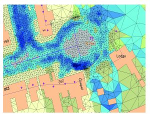
 Following BIM principles, we are helping the EA and Leicester City Council identify flood risks and develop an integrated strategy to manage them. Using techniques such as hydraulic modelling, we’re creating a flood map that covers the entire city, gathering detailed information about the region’s rivers to determine ‘pinch points’ where flooding might occur. BIM is not just about creating a 3D model, but also the integrity of data and information and how it’s managed and applied to a project. In this case, rather than developing a traditional BIM model using CAD drawings and other design software, we’re adopting BIM information processes to catalogue, organise, store and map this information in a consistent and standardised way.
This approach is in line with the Level 2 mandate, which requires all project information to be digitally stored at each stage of a project’s life cycle to ensure design and data constantly evolves along with the project or scheme. Our work is informing sustainable development in Leicester in a collaborative, standardised way, and setting best practice for flood risk management project data integration.
Opportunity, not cost
So the benefits are clear but how much is all this going to cost? There is a common misconception that BIM costs more and yes, there is an initial upfront cost of using BIM. Software upgrades and the employee training required to meet the Level 2 standards will involve a financial outlay but it is important to consider these alongside the long-term savings of using BIM.
BIM helps to reduce the operational expenditure of a flood risk asset, strategy or scheme, bringing potential savings that far outweigh the set up costs . If defined correctly from the outset, BIM can also give teams the ability to perform cost analysis — which can help them better understand and manage the cost impacts of design changes, as well as the whole life cost of the asset.
Business as usual
Uncertainties remain within some parts of the industry in the UK as to what BIM really is and what it can do for them as individuals or sectors. This has led to a lack of uptake in some areas. But BIM is here to stay. Yes, it will continue to evolve and develop but quite simply it must become business as usual. It is the route to more efficient project delivery, eliminating error, reducing risk and waste and bringing better value for money.
BIM playbook
To guide the implementation of BIM and help manage data on our projects, we’ve developed the AECOM BIM Playbook. The interactive online tool is believed to be the first of its kind in the industry, and gives our staff and project stakeholders an understanding of what to expect when delivering a BIM project. Structured to mirror the different stages of a project’s life cycle, each section of the Playbook contains all of the relevant information, documents, standards and templates for efficient BIM use.
BIM: Reducing the risk in Brent Cross
One of the first true BIM water projects in the UK, the Brent Cross Cricklewood regeneration project includes ambitious plans to build a new urban centre in north London over 20 years.
As lead designers on the project, we’re using BIM processes across our flood and water management, infrastructure and bridges teams to collaborate data and designs into a single source of project data, helping to improve design and eliminate risk.
To make space for the development, our flood and water management teams are using hydraulic modelling and flood mapping to realign the river, improve water quality and reduce flood risk to the area while bringing retail, residential and transport hubs together.
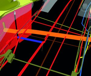
To eliminate design clashes, we’re using Autodesk Navisworks, a well-known BIM software platform that integrates 3D models from across AECOM project teams to eliminate costly errors, such as ensuring there’s enough headroom under a bridge for a river footpath.
BIM is helping unlock the river’s full potential, from reducing flood risk to increasing local biodiversity.
 We’re also using Bentley ProjectWise, a data cloud service which project teams use to upload and store designs and information from BIM projects to their computers, tablets or mobile devices into one digital platform that can be added to and evolves as the project progresses. This is what’s called a Common Data Environment (CDE) — a requisite under Level 2.
Creating a CDE across the Brent Cross project means we can share and integrate essential flood risk management data with all project teams including infrastructure and ecology. This helps to ensure the local community is protected, while also helping to deliver a vibrant new urban centre that unlocks the river’s full potential through a new riverside park and cycleway, and natural riparian tree and reed beds to increase local biodiversity and ecology.
Core Level 2 requirements: What you need to know
To meet Level 2, flood risk management consultants such as AECOM, local authorities and the EA, will need to use the following documents and procedures on all construction projects:
Employer Information Requirements (EIR): An EIR is a document that local authorities and all clients will be required to produce, this sets out what information they want from a contractor, the procedures, protocols, naming conventions and format, and how they’re going to use the information. It’s then up to the project team to meet this requirement.
BIM Execution Plan (BEP): This details how a project stakeholder plans to use BIM on a project, outlines staff and supply chain capabilities, which software and tools will be used, project roles and responsibilities, clash detection, level of definition and
file naming.
Common Data Environment (CDE): A CDE is an online platform typically chosen by the client. It contains and manages all project data and ensures naming conventions, workflows and approvals are followed throughout a project. A CDE must be set up at the beginning of a project; AECOM’s preferred CDE tool is Bentley ProjectWise.
Project Information Model (PIM): This includes data and documents linked to a 3D model all stored in a CDE; for example, when you click on a floodgate in a graphical model, information such as cost and other specific information will appear.
Construction Operations Building Information Exchange (COBie): A COBie is a spreadsheet that project teams add key data to, such as drawings and coordinates, to create a single and simple source of project information that can be opened and understood by everyone. This common data format allows project teams to easily transfer the information contained in the spreadsheet between different software packages.


